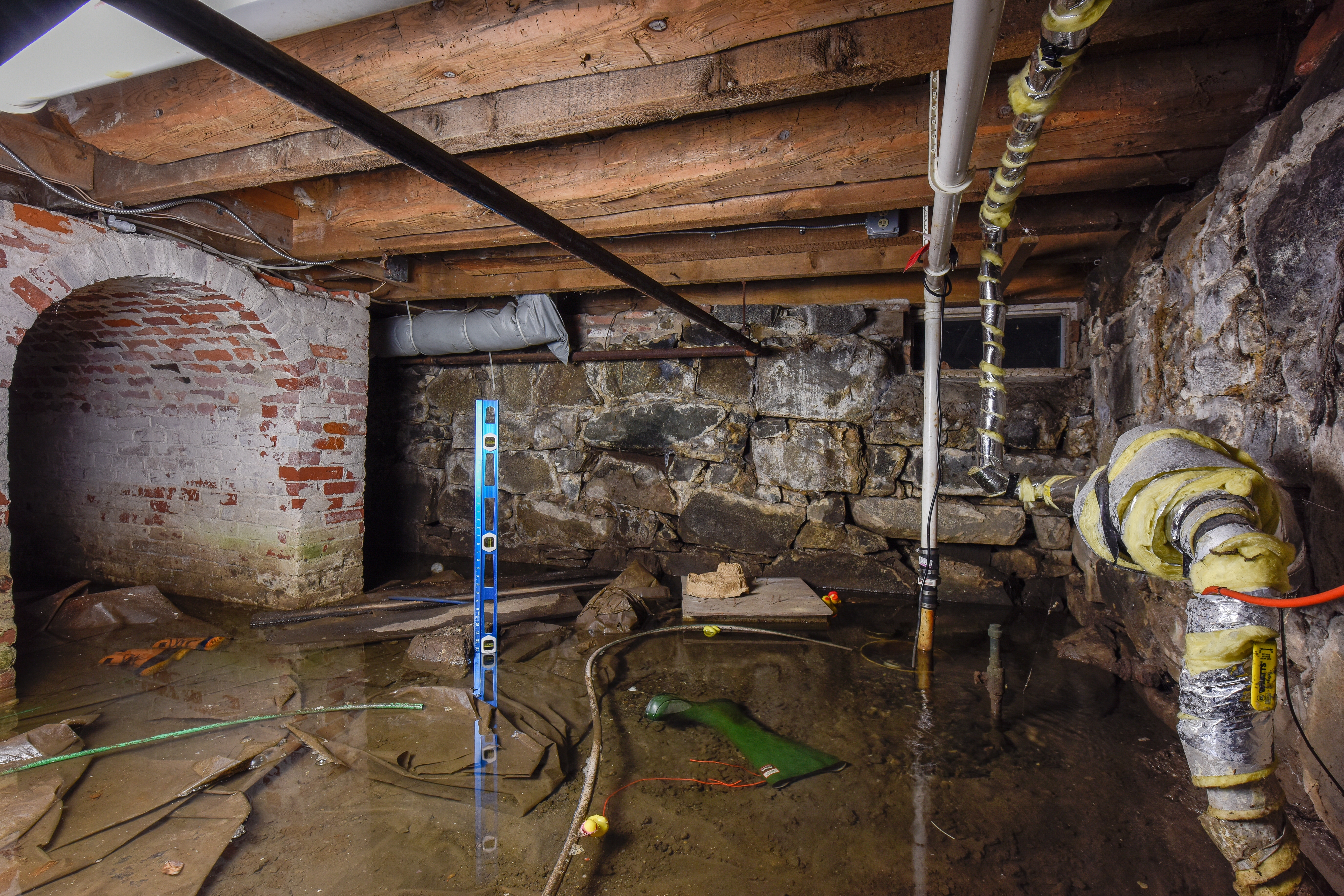
A 2010 study conducted at Strawbery Banke showed a link between basement flooding and the tides within the nearby Piscataqua River. Today, this research continues with the deployment of a new wireless water monitoring system inclusive of a suite of sensors, a wireless communications network, and a cloud database. Future sensor deployments are planned within other Strawbery Banke structures and dug wells across the museum's campus.
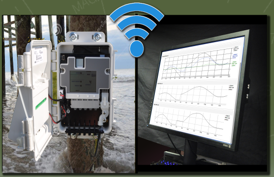
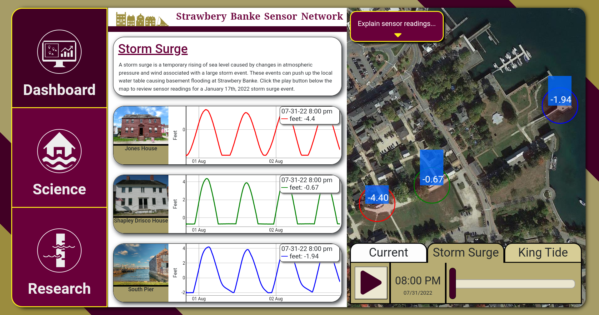
In 2021 the Strawbery Banke Museum opened a new major exhibit called "Water Has a Memory" for public viewing. As of 2022, a new interactive touch-screen kiosk was added to this exhibit to allow users to view current, king tide, and storm surge readings from water level sensors across the museum's water monitoring network. Data drawn from the system's cloud database via a Wi-Fi connection are graphed and mapped in real-time or historically via a user-operated time slider.
Long-term water level data collected at the Strawbery Banke Museum will be used to better understand the hydrodynamics of local flooding, tides, precipitation, storm surge events, and future increases in local sea levels. These data will also be used to better understand the effects that long-term flooding and humidity have on the deterioration of the museum's historic buildings. By coming to better understand the results of this research, the museum looks to mitigate better the effects of the local and global drivers affecting this historic site.
System design and implementation by University of New Hampshire, Geospatial Science Center (https://gis.unh.edu)